Data Products
QUIJOTE MFI wide survey at 11, 13, 17 and 19GHz
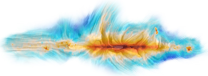
 We present QUIJOTE intensity and polarization maps in four frequency bands centred around 11, 13, 17 and 19 GHz, and covering approximately 30 000 deg2, including most of the Northern sky region. These maps result from 9 000 hours of observations taken between May 2013 and June 2018 with the first QUIJOTE instrument (MFI), and have angular resolutions of around one degree, and sensitivities in polarization within the range 35–40 μK per 1-degree beam, being a factor 2–4 worse in intensity. For more details, see Rubiño-Martin et al. (2023), "QUIJOTE scientific results – IV. A northern sky survey in intensity and polarization at 10–20GHz with the Multi-Frequency Instrument",
MNRAS accepted .
We present QUIJOTE intensity and polarization maps in four frequency bands centred around 11, 13, 17 and 19 GHz, and covering approximately 30 000 deg2, including most of the Northern sky region. These maps result from 9 000 hours of observations taken between May 2013 and June 2018 with the first QUIJOTE instrument (MFI), and have angular resolutions of around one degree, and sensitivities in polarization within the range 35–40 μK per 1-degree beam, being a factor 2–4 worse in intensity. For more details, see Rubiño-Martin et al. (2023), "QUIJOTE scientific results – IV. A northern sky survey in intensity and polarization at 10–20GHz with the Multi-Frequency Instrument",
MNRAS accepted .
Description of the data products
The following Explanatory Supplement ( PDF ) contains a complete description of all data products, which include the following items:
- Four frequency maps (11, 13, 17, 19 GHz) in intensity and polarization, both at native and one degree resolution. Maps at 11 and 13 GHz correspond to those produced from MFI horn 3. Maps at 17 and 19 GHz correspond to the weighted average of horns 2 and 4.
- The associated weight and hit maps for each frequency map at native resolution.
- One set of null tests maps (half1/2 for independent baselines).
- Reduced Instrument Model (RIMO), containing central frequencies, beams properties, beam profiles and window functions for each MFI horn, bandpasses and colour corrections.
In addition, this data release also includes derived data products from some of the accompanying papers:
- Catalogues of radio sources in the MFI wide survey maps ( Herranz et al. 2023 ).
- Component separated maps of the polarized synchrotron emission ( de la Hoz et al. 2023 ).
Download
All data products can be downloaded from this repository .
Acknowledgements
Please acknowledge the use of the QUIJOTE MFI wide survey data products by:
- citing the main QUIJOTE MFI wide survey paper ( Rubiño-Martin et al. 2023 ), and if using derived products, the relevant associated paper(s); and
- adding an acknowledgment statement: "Some of the presented results are based on observations obtained with the QUIJOTE experiment ( http://research.iac.es/proyecto/quijote )".
History
- Version 1. Released in January 2023.